Beirut blast devastation seen in new satellite images
The scale of devastation from Tuesday's Beirut blast can be seen in new satellite images that provide a sobering perspective of the pair of explosions that killed more than 100 people, injured 4,000 others and leveled several warehouses and buildings in the surrounding area.
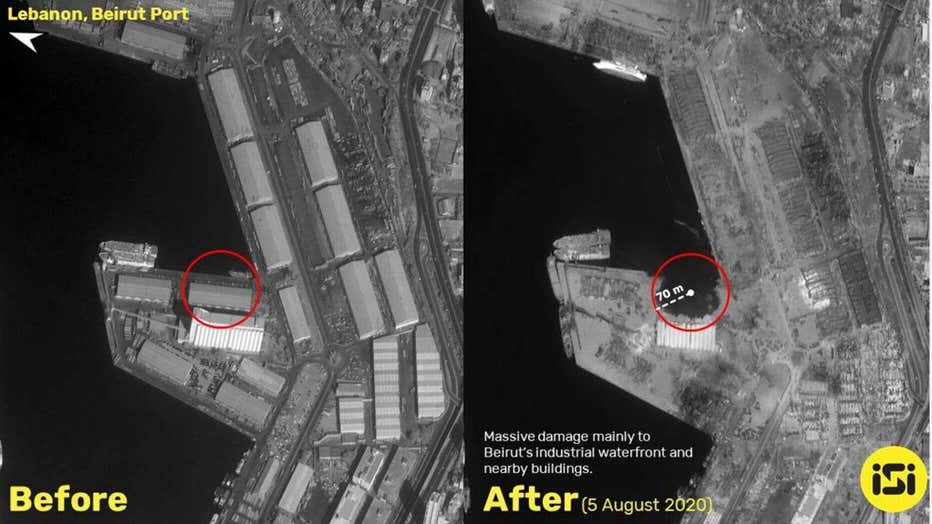
The new pictures from ISI Imagesat International show massive damage to the city's industrial waterfront following the blasts that erupted next to the Beirut Port Silos.

Side-by-side satellite images of the Beirut blast before and after (Photo: ISI Imagesat International)
Hospitals were also damaged and windows shattered miles away as the shockwave from the explosion moved from the industrial waterfront to the city's residential areas and shopping districts. The blast also changed the shoreline in the port, according to local reports.
Initially, President Trump claimed a bomb might have gone off in the city -- a statement that was contradicted by U.S. military officials as well as those in Lebanon.
The investigation into the Beirut blast seemed to show years of neglect over the storage of highly explosive materials, an official source familiar with the findings told Reuters.

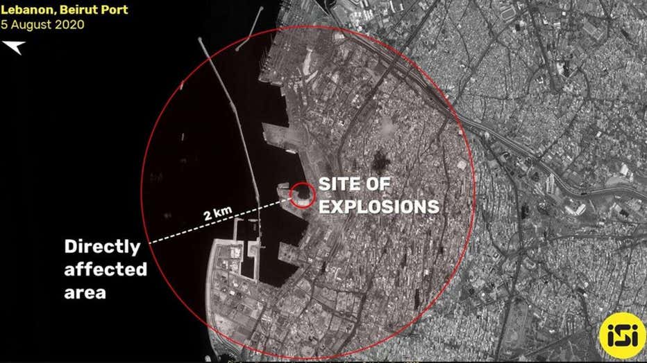
Satellite image of the aftermath of Beirut blast. (Photo credit: ISI Imagesat International)
Boaz Hayoun, owner of the Tamar Group, an Israeli firm that works closely with the Israeli government on safety and certification issues involving explosives, told The Associated Press that before the big explosion, in the center of the fire, "you can see sparks, you can hear sounds like popcorn and you can hear whistles. This is very specific behavior of fireworks, the visuals, the sounds, and the transformation from a slow burn to a massive explosion."
The blast, based on the crater and glass windows being blown out a distance away, exploded with the force equivalent to detonating at least 2.2 kilotons of TNT, Sim Tack, an analyst and weapons expert at the Texas-based private intelligence firm Stratfor, said.
Tuesday's explosion was the most powerful ever felt in Beirut, a city still scarred by a civil war that started three decades ago and crippled by a financial crisis rooted in years of corruption and economic mismanagement.

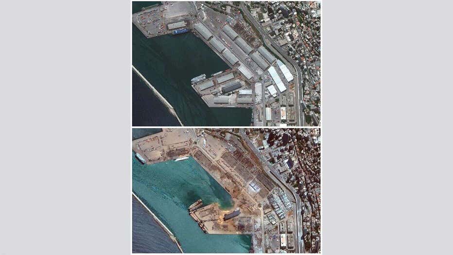
Satellite images show the port of Beirut and surrounding area in Lebanon, on June 9, 2020, (top) and the same area on Aug. 5, 2020, (bottom) the day after a massive explosion. (Photo credit: 2020 Maxar Technologies)
The head of Beirut Port, as well as the head of customs, said Wednesday that several attempts had been made asking for the dangerous materials involved in the blast to be removed but that no action by the judiciary had been taken.
Fireworks and 2,700 tons of ammonium nitrate confiscated from a cargo ship in 2014 are believed to have been the fuel that ignited the massive explosion.
Tuesday's blast also damaged a UNIFIL maritime task force ship that was docked at the port. A few UNIFIL naval peacekeepers were also injured, some of them seriously, according to a statement from the United Nations Interim Force in Lebanon.
The Associated Press contributed to this report.

