Philadelphia snow threat: What we know about the weekend storm
PHILADELPHIA - FOX 29's Weather Authority is tracking another winter weather scenario that could bring more flakes to the Philadelphia area just days after its first significant snowfall this winter.
Possible snowfall timeline
Models are currently showing the storm developing on Friday, then moving up the coast to spread some snow over the region from Friday night into Saturday morning:
- Friday night/ early Saturday morning: Snow expected to arrive
- Saturday morning: Snow showers
- Early Saturday afternoon: Snow turns to wintry mix, then rain
Potential snowfall
The storm's current path indicates light snowfall in New Jersey, Pennsylvania and Delaware, with just 1 to 2 inches expected for most places, though later model runs indicate it could bring just a dusting.
FOX 29's Kathy Orr says the storm is not a major snow event as of Wednesday evening, but will continue to track its path over the next couple of days.
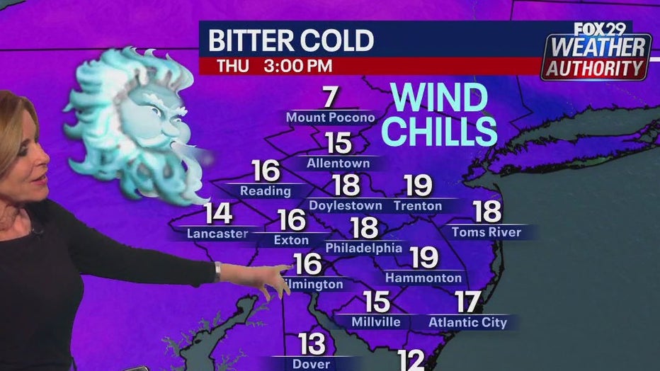
In the meantime, it is cold and will remain frigid the rest of the week.

At the bus stop tomorrow, dress those kids very warmly, as wind chills will be in the teens and single digits through 11 a.m. and only into the teens for everyone in the afternoon.
After the system moves away Saturday, winds will be calm for Sunday’s Eagles game at the Linc. Temperatures will be seasonably cold with highs around 40 at 4 p.m. and hitting the mid-30s by 7 p.m.
RELATED COVERAGE: Snow in Philadelphia this weekend? Forecast, timeline
Sunday and Monday see temps in the 40s, before dropping back into the low to mid 30s next week. No other snow opportunities are in the seven-day forecast.


