

Tornado warnings possible Monday as strong storms roll into Philadelphia area
Weather Authority: Sunday morning forecast
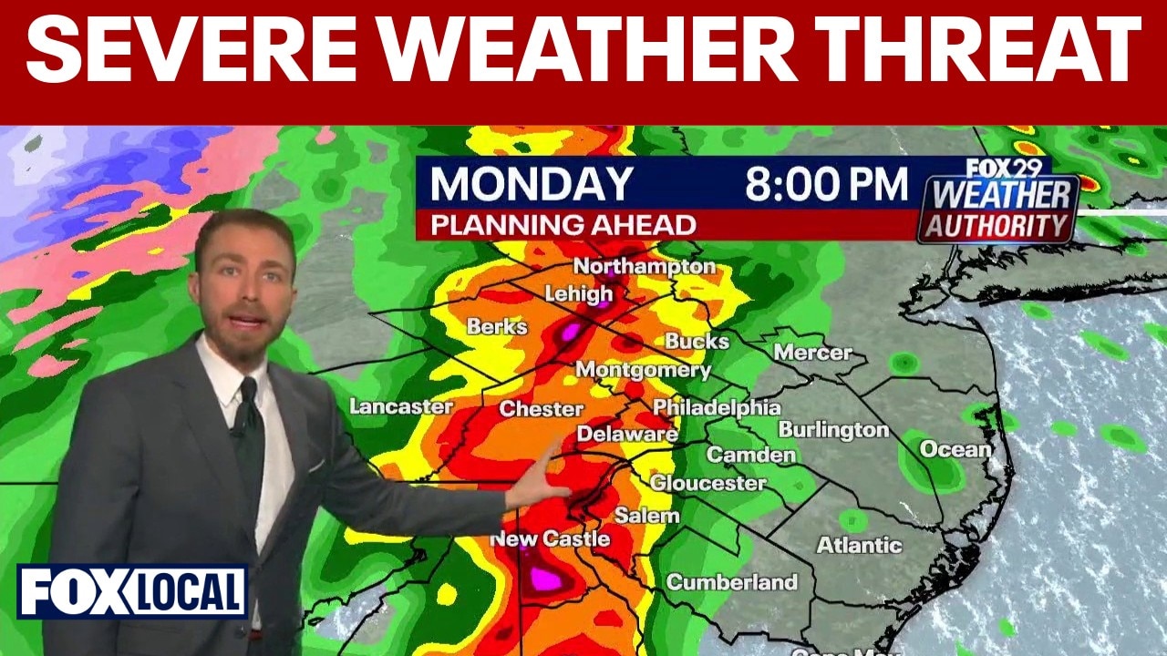
Storms are expected across the Philadelphia region on Monday after a mild weekend.
PHILADELPHIA - After a mild weekend, forecasters say rounds of storms with the potential for damaging winds and isolated tornadoes could impact the Philadelphia region on Monday.
What we know:
The first showers are expected to arrive overnight Sunday into early Monday morning. These initial storms are not expected to be particularly strong, but they could leave roads wet heading into the morning commute.
Some lingering showers may still be around during the early commute Monday, but forecasters say the weather may become more active as the day goes on.

Not everyone will see storms at the same time, but the atmosphere is expected to remain unstable enough for multiple rounds of severe weather throughout the day.
The strongest storms are most likely to develop around dinnertime and intensify as it moves through the region. These storms may bring heavy rain, frequent lightning, and strong wind gusts capable of causing damage.
Timing of strongest storms
Timeline:
The most intense weather is expected Monday evening:
- Around 8 p.m.: Storms could begin approaching the Philadelphia area.
- Around 9 p.m.: The line of storms is expected to move through the city.
- Late evening: Storms should weaken as they move into South Jersey and toward the shore before eventually clearing overnight.
Tornado risk
Local perspective:
While tornadoes are not guaranteed, forecasters say the storm system could produce isolated tornado warnings, particularly in areas such as Berks and Chester counties.
The biggest concern with any tornado in the region is the potential for uprooted trees and localized wind damage.
If a tornado warning is issued, residents should move to the lowest level of their home, preferably in a basement or an interior room away from windows.
The Source: Information for this story was provided by the FOX 29 Weather Team.