Tropical Storm Helene: How it could impact Philadelphia area

Tracking Tropical Storm Helene
FOX 29 Meteorologist Kathy Orr takes a look at how the potential Hurricane Helene will affect the Philadelphia area.
PHILADELPHIA - An eighth named storm is expected to make landfall this week after forming over the Caribbean Sea on Tuesday morning.
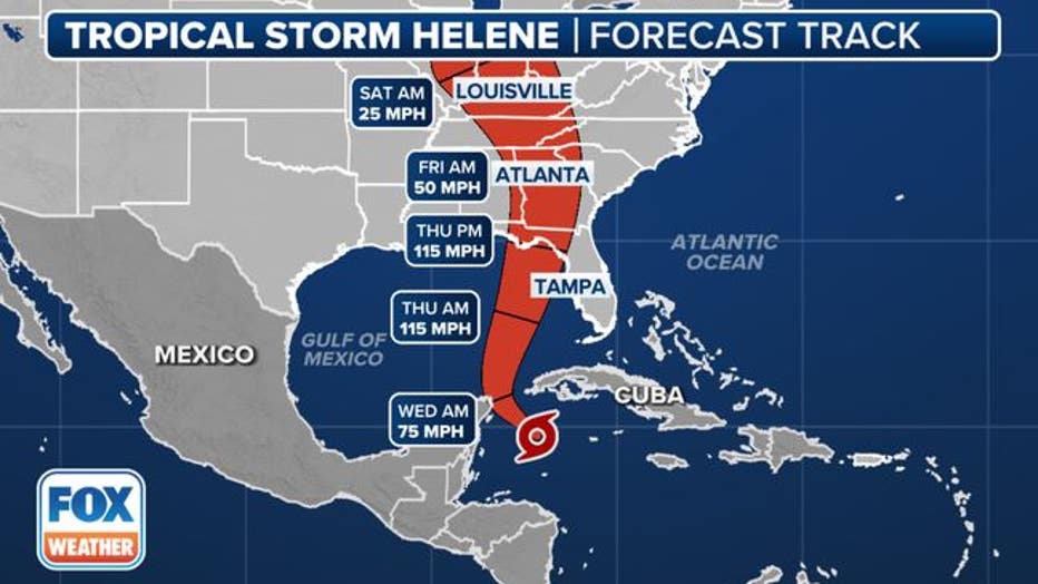
The National Hurricane Center says they expect Tropical Storm Helene to rapidly intensify into a hurricane in the Gulf of Mexico before bringing tropical storm-force winds, heavy rain and possibly tornadoes to Florida by Thursday morning.
Impacts on the Philadelphia area
FOX 29's Weather Authority is tracking Helene to see how the tropical storm could impact our region this week.
Kathy Orr says that tropical moisture is the wildcard that could bring some clouds, humidity and showers by Friday or Saturday.
A potential front could even push more rain from the Midwest into the Delaware Valley from Sunday into Monday.

Where is Tropical Storm Helene now?
FOX 35 in Orlando reports that Tropical Storm Helene is 180 miles east-southeast of Cozumel, Mexico, and 170 miles south-southeast of the western tip of Cuba.
It's traveling northwest at 12 mph with sustained winds of 45 mph. A northward to north-northeastward motion at a faster forward speed is expected on Wednesday and Thursday.
"On the forecast track, the center of Helene will move across the far northwestern Caribbean Sea through tonight, and then move across the eastern Gulf of Mexico Wednesday and Thursday, potentially reaching the Gulf coast of Florida late Thursday," the NHC said.
When is Tropical Storm Helene expected to hit Florida?
The data is not concrete yet, but a hurricane is expected to be off the coast of Florida by Thursday morning.
Where it will make landfall, if it will make landfall over Florida, isn't entirely certain. We'll find out additional details in the hours and days ahead, as the system continues to develop.
Where is the tropical storm headed?
Tropical Storm Helene is expected to "rapidly intensify" into Hurricane Helene on Wednesday. Some models suggest it could reach major hurricane status - Category 3 or higher - by Thursday.

